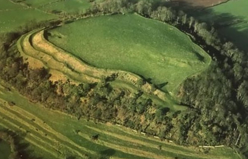
CAMELOT has several notable contenders for potential locations throughout Britain and Wales, most or all of which I hope to investigate over the following few months. Cadbury did not become one of them until 1542, when John Leland reported that the locals around Somerset considered their location to be the legitimate plot of land. And just look at it from an aerial perspective, why don’t you? At Cadbury, we are given a massive earth mound to work with, complete with cake-like layers. Those are walls if I do say so myself. Several layers of them in fact. The surface isn’t shaved down either. It slopes up towards the back, hinting at a former structure. Whatever existed here before the 536-heat index event was a mighty large fortress, indeed.
Excavations were led by Leslie Alcock from 1966 to 1970, gaining much media attention. Alcock was a Professor of Archaeology at the University of Glasgow and one of the leading archaeologists of Early Medieval Britain. His dig revealed in official chronology terms that the site seems to have been occupied as early as the 4th millennium BC, though far more importantly, that it was then occupied by a major Brittonic ruler in the whereabouts of 470 AD, pitting us smack dab in Arthur territory. He also claimed that the works presented by far the largest known fortification of the period, double the size of comparative fortresses. Not only that, but it also came complete with Mediterranean artifacts, highlighting the extent of its trade routes. Even more provocative is his other conclusion, that the fortress was all but abandoned or destroyed by 580, and that the inclusion of Saxon artifacts hints at their possible conquest.
You can read the entire report in my 537 AD: The Death of Camelot investigation.
UPDATE 5/18/25: 537 AD: The Death of Camelot

